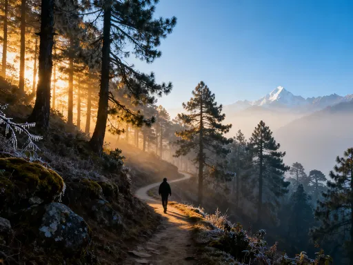
Rome’s Hidden Hills: Why Walking This City Feels Like Climbing a Secret Staircase
You know that feeling when you're just trying to get from the Colosseum to a quiet espresso bar, but Rome keeps throwing another steep cobblestone path at you? Yeah, that’s the terrain talking. Rome isn’t just ancient ruins and pasta—it’s a city built on seven hills, and every step tells a story. I never expected how much the landscape would shape my trip, from breathless climbs to rooftop views worth every ache. Let me break down how Rome’s special terrain changes everything—from where you walk, to where you rest, to what you actually see. The city's topography is not merely a backdrop; it is an active participant in your journey. What looks like a simple stroll on a map can turn into a lung-burning ascent. Yet, those same inclines offer some of the most intimate and breathtaking experiences Rome has to offer. Understanding this vertical rhythm is the key to traveling not just comfortably, but meaningfully.
The Seven Hills Are Real (And They Rule the City)
Rome’s foundation is not just metaphorical—it is geological, historical, and ever-present in the daily experience of moving through the city. The legendary Seven Hills—Palatine, Capitoline, Aventine, Caelian, Esquiline, Viminal, and Quirinal—were not chosen at random by Rome’s early settlers. These elevated positions offered strategic defense, drainage advantages, and separation from the malaria-prone marshlands of the Tiber River floodplain. Over centuries, as the city expanded, the influence of these hills did not fade. Instead, they became the bones of Rome’s urban structure, shaping street patterns, neighborhood identities, and even microclimates.
Today, a traveler walking from the Roman Forum toward Trastevere might not realize they are descending from the Palatine and crossing the ancient valley of the Circus Maximus before climbing again into the elevated streets of the Janiculum ridge. Each shift in elevation corresponds to a shift in atmosphere. Lower areas, such as the Tiber islands and riverbanks, tend to be warmer and more humid, especially in summer. In contrast, higher districts like the Aventine or Pincio Hill enjoy cooler breezes and slightly lower temperatures, making them favored retreats for both locals and observant tourists. These subtle climatic differences are a direct result of Rome’s hilly layout.
The city’s historical development reinforces this vertical logic. The Palatine Hill, traditionally considered the birthplace of Rome where Romulus founded the city, remains one of the most elevated and archaeologically rich zones. Walking its paths today, visitors navigate winding trails and stone steps that follow the natural contours of the land. Similarly, the Capitoline Hill, redesigned by Michelangelo, still serves as a civic and symbolic center, accessible via a grand ramp that acknowledges the effort required to reach this seat of power. Even modern construction respects these ancient elevations. New buildings, infrastructure, and even utility lines must account for gradients that have dictated movement for over two millennia.
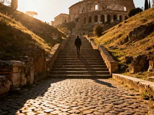
Understanding the reality of the Seven Hills transforms the way one reads a map. What appears as a straight line between two attractions may involve multiple ascents and descents. For example, a route from the Colosseum to the Mouth of Truth requires crossing a valley and then climbing toward the Aventine, a journey that feels far longer than the distance suggests. The hills do not merely add physical challenge—they create rhythm, pacing, and surprise in the urban experience. Recognizing their dominance allows travelers to plan with greater awareness, turning what might feel like random obstacles into intentional parts of a deeper exploration.
Cobblestones, Stairs, and Uneven Paths: What Your Feet Will Face
If Rome’s hills define its verticality, then its surfaces define the texture of every step. The city’s iconic sampietrini—irregular, basalt cobblestones laid in geometric patterns—are as much a part of Rome’s identity as the Colosseum or the Pantheon. These stones have endured for centuries, bearing the weight of chariots, horse-drawn carriages, and now, millions of tourist footsteps. While visually charming and historically significant, they present a unique challenge for modern travelers, particularly on inclines. Walking on sampietrini is rarely smooth. The uneven gaps between stones, combined with natural wear and occasional shifting, create a surface that demands constant attention and balance.
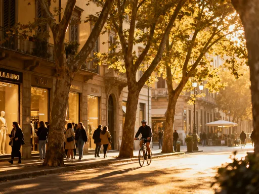
In neighborhoods like Trastevere, the challenge intensifies. Narrow alleyways wind upward with no warning, transforming from flat passageways into steep, cobbled ascents. These paths were not designed for comfort or accessibility but evolved organically over centuries, following the natural slope of the land. Rain turns them into slippery hazards, and summer heat radiates from the dark stone, making each step feel heavier. Even in well-maintained areas, the lack of consistent pavement means ankles must constantly adjust, increasing fatigue over time. For visitors unaccustomed to such terrain, a day of sightseeing can quickly become a test of endurance.
Staircases are another defining feature of Rome’s pedestrian landscape. Unlike many modern cities that rely on elevators or ramps, Rome frequently uses stairs as primary connectors between districts. The Spanish Steps, while famous, are only the most visible example. Lesser-known staircases, such as those linking the Campo de’ Fiori to the Piazza di San Giovanni in Laterano or the hidden steps between the Aventine and Ripa districts, are equally demanding. These are not tourist attractions but functional routes used by locals, often without handrails or lighting. Some are shallow and wide, others narrow and steep, requiring careful footing, especially when carrying bags or traveling with children.
The combination of cobblestones, stairs, and natural slopes means that walking in Rome is rarely a flat, predictable experience. Even routes that appear level on a two-dimensional map can involve subtle but relentless inclines. The city does not accommodate linear movement—it invites exploration through elevation change. This reality requires travelers to shift their expectations. Rather than aiming to cover maximum ground, a more rewarding approach is to embrace the rhythm of ascent and descent, allowing the terrain to guide the pace. Each uneven path, each unexpected staircase, becomes not an obstacle but a reminder of Rome’s layered history and living geography.
Footwear That Works (and What to Avoid at All Costs)
No single factor affects the enjoyment of a Rome trip more than footwear. The city’s relentless terrain turns shoes from a fashion choice into a functional necessity. The wrong pair can transform a dream vacation into a daily ordeal of blisters, sore feet, and shortened outings. The right pair, however, allows for longer walks, more exploration, and greater comfort on even the steepest inclines. The ideal Rome shoe balances support, grip, and breathability, designed to handle hours of walking on uneven surfaces under variable conditions.
Supportive soles are non-negotiable. Look for shoes with cushioned midsoles and firm heel counters that stabilize the foot on irregular cobblestones. Athletic walking shoes or lightweight hiking boots often perform better than traditional dress shoes or fashion sneakers. Brands known for durability and ergonomic design can make a significant difference, but even lesser-known models with good reviews can suffice if they meet key criteria. Ankle support is particularly valuable in areas with frequent staircases or loose stones, helping to prevent rolls and sprains. Closed-toe shoes with secure lacing systems are strongly recommended over slip-ons or elastic-sided styles, which may loosen over time.
Grip is equally critical. Smooth leather soles, common in stylish Italian footwear, may look elegant but offer little traction on wet cobblestones. Rubber outsoles with multidirectional tread patterns provide better grip, especially on damp surfaces. Some travelers swear by shoes with Vibram or similar high-traction soles, particularly when planning visits to parks or outer hills like the Janiculum. Breathable materials such as mesh or perforated leather help manage foot temperature during long days in the sun, reducing sweat and the risk of blisters. Moisture-wicking socks made from merino wool or synthetic blends can further enhance comfort.
There are, however, common footwear choices that should be avoided. Flat sandals, especially those without arch support or secure straps, are a frequent source of discomfort. While popular in warm weather, they offer no protection against sharp stones or sudden slips. High heels, regardless of height, are impractical on most Roman streets and can be dangerous on stairs. Even low block heels struggle with the instability of sampietrini. Flip-flops and open-back mules are unsuitable for anything beyond brief indoor visits. Travelers who arrive unprepared can find solutions in Rome’s many shoe stores, particularly around tourist areas like Via del Corso or near major train stations. Many shops offer quick replacements with comfort-focused designs, and some even specialize in travel footwear.
The best approach is to break in shoes well before the trip. Wearing new or stiff footwear on the first day of walking can lead to painful consequences. Test shoes on inclined surfaces and uneven ground to simulate Roman conditions. Consider bringing a second pair for evening wear—lighter, more stylish options that can be worn briefly in flatter, safer areas. Ultimately, prioritizing function over fashion leads to greater freedom. When your feet feel good, you’re more likely to keep walking, discovering hidden courtyards, quiet piazzas, and rooftop views that only come after a climb.
Mapping the Uphills: Smart Navigation in a Vertical City
Most digital maps present Rome as a flat grid of streets and landmarks, obscuring the city’s defining feature: its elevation changes. A route that appears direct on a standard map may involve a series of exhausting climbs and descents. To navigate Rome wisely, travelers must go beyond basic navigation tools and incorporate topographic awareness into their planning. Fortunately, modern technology makes this easier than ever. Applications like Google Maps now offer terrain layers that reveal elevation shifts, while specialized platforms such as Komoot and AllTrails provide detailed gradient analysis and route profiles, helping users anticipate the physical demands of each path.
Using these tools, it becomes possible to identify gentler alternatives to steep tourist routes. For example, rather than ascending the Spanish Steps directly, one might take a longer but more gradual path through the Villa Borghese gardens, which follow natural slopes with paved, accessible walkways. Similarly, approaching the Trastevere district from the Ponte Sisto bridge leads to immediate climbs, while entering from the Janiculum Hill offers a slower ascent with panoramic views. These alternative routes are not only easier on the body but often more scenic, passing through residential areas, small parks, and lesser-known landmarks.
Another strategy is to study elevation maps before setting out each day. A quick glance at a topographic overlay can reveal whether a planned walk involves a net gain or loss in elevation. Planning downhill routes in the morning, when energy levels are high, and saving uphill returns for later—when fatigue sets in—can improve overall comfort. Some travelers find it helpful to divide the city into elevation zones and group attractions accordingly. For instance, focusing on the Capitoline and Palatine Hills in a single day minimizes unnecessary valley crossings. Staying in accommodations located near major attractions can also reduce daily elevation changes, particularly for those with mobility concerns.
It’s also worth noting that some of the most photographed routes are among the most physically demanding. The climb to the summit of the Aventine Hill, while rewarding, involves sustained effort. The path from the Circus Maximus to the Palatine requires navigating uneven steps and exposed sun. By using topographic tools, travelers can make informed choices about which challenges are worth undertaking and which might be better approached by alternative means. The goal is not to avoid Rome’s hills entirely—they are part of its charm—but to engage with them intentionally, respecting their demands while maximizing enjoyment.
When to Walk, When to Ride: Public Transit and Terrain Trade-offs
Even the most enthusiastic walker will eventually meet a hill that defeats them. Rome’s public transportation system offers a vital alternative, but it comes with its own terrain-related challenges. The city’s metro, buses, and trams can save energy and time, but access to these services is not always straightforward. Stations, stops, and platforms are often located at the bottom of hills or require navigating multiple flights of stairs, elevators, or escalators that may not always be operational. Understanding the limitations and advantages of each option is essential for efficient, stress-free travel.
The metro, while limited to three lines, is one of the most reliable ways to cross the city quickly. However, not all stations are equally accessible. Some, like those on the newer sections of Line B, include elevators and ramps, while older stations may have only stair access. For example, the Colosseo station, though centrally located, requires climbing numerous steps to reach street level. Travelers with heavy luggage or mobility issues should research station layouts in advance. Using apps that indicate elevator availability can prevent frustrating surprises. When possible, pairing metro use with short bus rides or flat walking routes improves accessibility.
City buses offer greater coverage, reaching neighborhoods that the metro does not serve. Many routes follow major roads with gentler gradients, making them useful for avoiding steep climbs. However, bus stops are not always located near final destinations, and the last leg of a journey may still involve a challenging ascent. Additionally, buses can be crowded, slow during peak hours, and difficult to navigate for first-time users. The tram system, though smaller, serves key areas like Trastevere and the Vatican, often running along flatter corridors. Trams generally have steps at entry points, so boarding may require assistance for some travelers.
The decision to walk or ride should be based on daily energy levels, weather conditions, and the specific route. On hot days, conserving energy for afternoon visits to museums or gardens may mean taking a bus to avoid midday climbs. After a long morning of walking, using public transit for the return trip allows for rest and recovery. Some travelers adopt a hybrid approach—walking to a metro station at the top of a hill, riding across the city, then walking uphill again at the destination, treating elevation as part of the adventure rather than a burden. The key is flexibility. Rome rewards those who adapt to its rhythms, using transportation not as a surrender to the hills, but as a strategic tool to enhance exploration.
Hidden Rewards: The Views and Vibes Only Hills Can Offer
For all their physical demands, Rome’s hills deliver rewards that flat cities cannot match. The effort of climbing is consistently repaid with moments of quiet beauty, sweeping vistas, and a sense of discovery. Elevated spaces in Rome tend to be less crowded, offering respite from the noise and congestion of major tourist zones. They provide not just visual panoramas but emotional elevation—a shift in perspective that transforms the experience of the city.
The Aventine Hill is a prime example. Far from the bustle of the Roman Forum, this residential area feels like a village within the city. At its summit, the Orange Garden (Giardino degli Aranci) offers one of Rome’s most iconic views: a straight-on perspective of St. Peter’s Basilica framed by a keyhole in the door of the Priory of the Knights of Malta. This moment of framed perfection is only accessible after a steady climb, making it feel earned rather than given. The garden itself is serene, with citrus trees, shaded benches, and a peaceful atmosphere rare in central Rome.
Similarly, the Pincio Terrace in the Villa Borghese gardens provides a grand, sweeping panorama of the Piazza del Popolo and the historic center. Arriving here after a walk through the park’s tree-lined paths feels like reaching a natural amphitheater. At sunset, the terrace fills with locals and thoughtful travelers, all sharing in the quiet awe of the city spread below. Other elevated spots, like the Janiculum Hill, offer 360-degree views with minimal crowds. The panoramic terrace there, marked by a statue of Garibaldi, overlooks the Tiber, the dome of St. Peter’s, and the distant Alban Hills. These locations are not just photo opportunities—they are places of reflection, where the rhythm of the city slows and the landscape speaks.
Beyond views, higher ground often means fresher air, cooler temperatures, and a different social atmosphere. Rooftop cafes, small churches, and hidden gardens are more common on the hills, creating pockets of tranquility. The climb filters out casual visitors, leaving space for deeper connection. Children fly kites in open fields, couples read on benches, and elderly Romans enjoy afternoon walks in shaded lanes. These moments of everyday life, visible only to those willing to ascend, reveal a more intimate Rome—one that exists beyond postcard images and guided tours.
Putting It All Together: Planning a Terrain-Smart Rome Itinerary
Traveling wisely in Rome means designing a daily rhythm that respects the city’s physical nature. A terrain-smart itinerary is not just about comfort; it is about depth, sustainability, and joy. By organizing days around elevation, clustering nearby attractions, and building in rest, travelers can experience more of Rome without exhaustion. The goal is not to conquer the hills but to move with them, allowing the landscape to shape a richer, more authentic journey.
Start by grouping activities by elevation zone. The historic center, encompassing the Capitoline, Palatine, and Forum, forms one cluster. Plan to visit these sites on a single day, minimizing backtracking across valleys. Similarly, the Villa Borghese and Pincio Hill can be combined with a visit to the Galleria Borghese, using the park’s gradual paths to connect experiences. Trastevere and the Janiculum work well together, especially in the late afternoon when the light is soft and the climb less punishing in the heat.
Consider the direction of movement. Begin days with downhill walks when energy is high, saving uphill returns for later, possibly using public transit. Schedule indoor activities—museums, churches, cafes—during the hottest hours, when climbing is least appealing. Use lunch breaks as opportunities to rest in shaded piazzas or garden cafes, particularly in elevated areas where breezes provide relief. Choose accommodations with easy access to flat routes or reliable transportation, especially if traveling with children or older adults.
Build in flexibility. Some days will feel more tiring than others. Allow time for spontaneous stops, extra coffee breaks, or quiet moments in a hilltop garden. Let the terrain guide you—sometimes the best discoveries happen when you follow a path simply because it leads upward and the view looks promising. By embracing Rome’s hills not as obstacles but as invitations, travelers unlock a deeper relationship with the city. Each step becomes part of a conversation with history, geography, and human endurance. In the end, it is not just the destinations that matter, but the way we rise to meet them.